
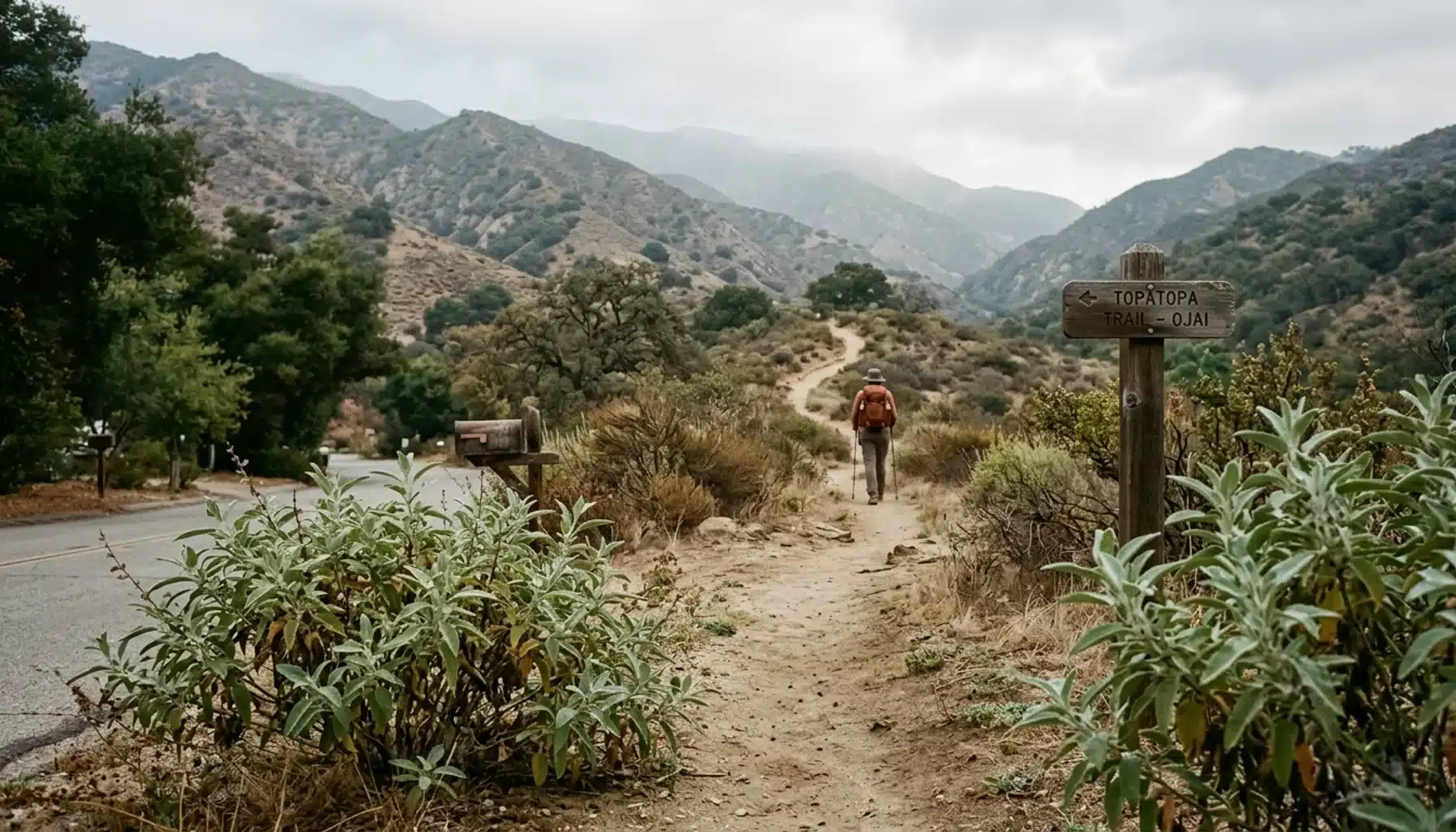
The Valley View Preserve Fox Canyon trailhead is a walk-in access point reached from Signal Street in Ojai, not a parking lot. The Ojai Valley Land Conservancy recommends parking at the Pratt Trailhead and walking to Shelf Road. From there, John’s Fox Canyon Trail climbs about one mile and 800 feet to Foothill Trail, with open views across the Ojai Valley.
Key Takeaways
- The Fox Canyon trailhead is reached on foot via Shelf Road from Signal Street; the official preserve guidance points you to the Pratt Trailhead for parking.
- Published mileage ranges from a one-mile trail segment to loops of roughly 2.6 to 3.5 miles, because each source measures a different route.
- Fox Canyon is steep, rocky, and mostly exposed, so it suits fit beginners with water and good shoes better than small children or casual strollers.
- Mountain bikers should skip it: VenturaCountyTrails.org gives Fox Canyon a T5 technical rating and does not recommend it for all but the most experienced riders.
- Guests of Ojai Vacation Home, a two-acre orchard on Ojai’s East End that sleeps up to 5, can pair a morning on the preserve with an evening in the hot tub.
Most guides to this hike agree on the views and disagree on nearly everything else. They differ on where to park, how far it is, and how hard it feels. That gap sends visitors circling Signal Street for a lot that does not exist. This guide sorts the conflicting numbers and gives you a plan you can follow.
At Ojai Vacation Home, set in a working citrus and avocado orchard on Ojai’s East End, we field this question from hiking guests every season. As of 2026, the safest habit is to check the Ojai Valley Land Conservancy (OVLC) trail updates page before you leave, since closures and access notes change.
Where Is the Valley View Preserve Fox Canyon Trailhead, Exactly?
The Fox Canyon trailhead is the start of John’s Fox Canyon Trail inside Valley View Preserve, a 195-acre property managed by the Ojai Valley Land Conservancy. You reach it on foot by following Shelf Road from Signal Street. Think of it as a trail entrance with a kiosk and map, not a destination with its own parking area.
What the official guidance says
OVLC recommends parking at the Pratt Trailhead, then walking in from Signal Street to Shelf Road to reach the Fox Canyon entrance. An Ojai Valley News route description places Pratt Trailhead parking about a quarter mile left off Signal Street, near the top of the hill. Shelf Road then follows an avocado orchard back toward the trail.
Why some guides say something different
A 2020 account on Hiking Girl with Dog describes free street parking leading up to the trailhead and lists coordinates of 34.462290, -119.245875. Treat that as one hiker’s record from six years ago. Street signs and neighborhood rules change, so follow the official Pratt Trailhead guidance and use the coordinates only as a rough map pin.
How Do You Get Directions and Park Near the Pratt Trailhead?
The Pratt Trailhead is the parking and starting point OVLC recommends for reaching the Fox Canyon trailhead, sitting off Signal Street in the Topatopa foothills above Ojai. Drive time from the East End varies with valley traffic, so check a live map and leave margin, especially on weekend mornings.
- Navigate to Signal Street in Ojai and climb toward the top of the hill.
- Look for Pratt Trailhead parking about a quarter mile to the left off Signal Street, per the Ojai Valley News route guide.
- Park there rather than blocking residential driveways along the street.
- Walk from Signal Street onto Shelf Road, which runs alongside an avocado orchard.
- Find the kiosk with the preserve map at the trail entrance before you start climbing.
Download an offline map before you leave. The 2020 report noted no restroom at the preserve and no fee or permit at that time, so confirm current rules on the OVLC site and arrive with what you need.
What Is the Fox Canyon Trail Like for Hikers?
John’s Fox Canyon Trail is a steep, switchbacked climb up a chaparral hillside from Shelf Road to Foothill Trail. The Sunido Inn guide says the trail was built in six months. VenturaCountyTrails.org describes many rocky steps, especially at the switchbacks, which slow your pace more than the mileage suggests.
Shade is scarce. The 2020 loop account calls Fox Canyon uphill, switchbacked, and without shade, and that route reached a maximum altitude of 1,665 feet. You earn the view the honest way: your calves feel it first, and the valley opens up behind you with each turn. The first stretch beside the orchard is the easiest ground you will cover, so save some energy for the switchbacks above it.
At the top you meet Foothill Trail. Head west to connect with Pratt Trail, or east toward Luci’s Trail, which starts just east of Fox Canyon and is shorter but steeper, with more switchbacks. If your legs are already tired at the junction, the Pratt side is the gentler way down.
Hikers who want a longer day can continue toward Topatopa Bluffs, Nordhoff Ridge, and Nordhoff Peak. Those routes connect to Los Padres National Forest, so see the Los Padres Forest resources and pack for a much bigger outing.
How Long Is the Fox Canyon Hike, and Why Do the Numbers Disagree?
The Fox Canyon hike is one mile of trail, but published distances run from about 2.6 to 3.5 miles because sources measure different routes. Some count only the trail segment, some an out-and-back, and some a full loop that adds Pratt Trail, Foothill Trail, and the walk back along Shelf Road.
| Source | Route described | Distance | Climb or time |
|---|---|---|---|
| OVLC preserve page | John’s Fox Canyon Trail only | 1 mile | 800 feet of climbing |
| VenturaCountyTrails.org | Fox Canyon, Shelf Road to Foothill Trail | 1.0 mile | 620 feet of gain; T5 technical rating |
| OVLC Take a Hike page | Fox/Luci’s Loop from Signal Street | 3.2 miles | Time not stated |
| Ojai Valley News | Pratt, Foothill, and Fox Canyon loop | Roughly 3.5 miles | About two hours for most hikers |
| AllTrails listing | Pratt, Foothill, and Fox Canyon loop | About 3.2 miles | Estimated 1 hour 45 minutes |
| 2020 hiker report | Clockwise loop, one hiker’s record | 2.6 miles round trip | 820 feet of gain |
The 800-foot and 620-foot figures describe the same one-mile climb with different profile definitions. Plan on the loop numbers for time, and use the table as a range rather than a promise. A two-hour window with photo stops is realistic for a fit hiker.
How Hard Is Fox Canyon for Families, Beginners, and Bikes?
Fox Canyon is a moderate-to-strenuous hike for fitness, with a technical trail surface that matters more than the distance. Some guides label the overall loop moderate or beginner-to-moderate, while VenturaCountyTrails.org assigns the Fox Canyon segment a T5 technical rating. Both can be true: T5 is a mountain-bike scale.
For walkers, the practical difficulty is sustained climbing, loose rock, and sun. A fit adult or an active teen will manage it with water and sturdy shoes. Toddlers and anyone with knee trouble should consider a gentler route from our list of beginner and family hikes near Ojai.
On bikes, the answer is blunt. VenturaCountyTrails.org describes Fox Canyon as climbing from Shelf Road to Foothill Trail and not recommended for all but the most experienced mountain bikers. If you want bike riding, check the OVLC Trail Finder for current trail rules before you load the car.
One routing opinion: climbing Fox Canyon is a hard, concentrated effort, while descending it means picking down rocky steps. If your knees complain on descents, go up Pratt and come down on Fox Canyon only if you trust your footing.
What Should You Bring, and When Should You Go?
Treat Fox Canyon as an exposed foothill climb: carry more water than the mileage suggests, wear shoes with grip, and start early. With no shade and no restroom reported at the preserve, you carry everything you need from the car.
- Water: bring plenty for a roughly two-hour loop, and more in warm months.
- Footwear: trail shoes or boots; the rocky steps punish smooth soles.
- Sun protection: hat, sunscreen, and sunglasses for the shade-free climb.
- Navigation: an offline map and the kiosk photo from the entrance.
Start in the morning, especially in summer, so the climb happens before the heat builds. Spring brings greener hillsides, though weather and conditions shift; our Ojai weather guide breaks down what to pack by season. Ventura County recorded 3.344 million visitors in 2026, so popular windows like holiday weekends deserve earlier starts.
Skip a late finish. The Pink Moment, the rose glow that tints the Topatopa ridgeline just after sunset, is better enjoyed from the porch than from rocky steps in fading light. For orchard-side viewing spots, see where to see the Pink Moment in Ojai.
What Are the Best Hikes in Ojai for Valley Views?
The best Ojai hikes for valley views are the foothill routes that gain height quickly, and the Fox Canyon loop at Valley View Preserve offers one of the best effort-to-view ratios for a half-day outing. Your best pick depends on how much climbing you want and how much time you have.
For a short, steep payoff, choose Fox Canyon or its steeper neighbor, Luci’s Trail. OVLC’s Fox/Luci’s Loop is described as 3.2 miles from the Signal Street entrance. For a full-day push toward big ridgelines, our Chief Peak hike guide covers trailhead, difficulty, and best season.
If anyone in your group wants flat ground instead, Ojai Meadows Preserve is an easy in-town nature walk with flat trails and interpretive signage. It does not give you the valley panorama, but it works as a rest-day walk. Our full Ojai hiking guide sorts trails by season.
OVLC also publishes a calendar of guided walks. If you prefer a docent over a map, check the events calendar before you plan your dates.
Is Valley View Preserve a Hidden Gem in Ojai?
Valley View Preserve is a well-documented local favorite rather than a secret. OVLC lists it, Ojai Valley News has written about it, and AllTrails has a loop entry. What keeps it feeling quieter than a headline trail is the walk-in access and the lack of a dedicated parking lot at the Fox Canyon entrance.
The real insider details are logistical: park at Pratt Trailhead, take Shelf Road past the avocado orchard, and decide your loop direction before you start. Those choices turn a confusing scramble into a clean two-hour loop. The orchard along Shelf Road is a working avocado grove, so stay on the path and leave the fruit alone.
Calling it a hidden gem would oversell it. The climb is exposed and unforgiving, and in midday heat many hikers will wish they had started two hours earlier. Go for the valley view, not for solitude on a holiday weekend.
Where Should You Stay and What Should You Do After the Hike?
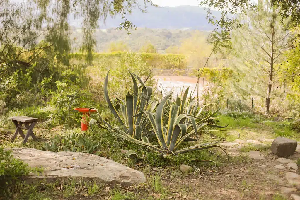
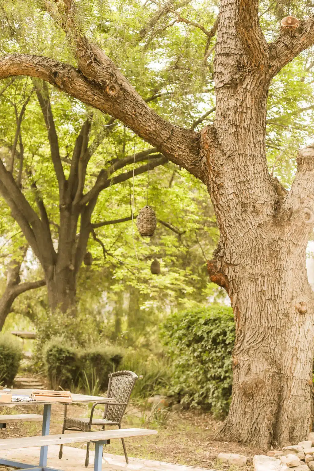
The best base for a Valley View Preserve day is a quiet property on Ojai’s East End with a hot soak and a porch to come back to. Ojai Vacation Home, nicknamed Pixie Palace by guests, is a one-story ranch home with 2 bedrooms, 2 bathrooms, and room for up to 5 guests on two acres of citrus and avocado orchard.
After a dusty descent, the 8-foot redwood hot tub and the hammocks come in handy, and the clay tennis court gives group members who skipped the climb something to do. The property sits among pixie tangerine, lemon, orange, pomegranate, persimmon, and macadamia trees, with wide views of the valley and mountain ranges. Check-in is at 4:00 pm and check-out is at 11am, so a morning hike on departure day works.
If you want dinner without driving, guests can arrange a private chef through yhangry, from relaxed BBQ and family dinners to multi-course meals. For a hike-day breakfast, see our picks for the best breakfast in Ojai. To compare neighborhoods, our guide to where to stay in Ojai covers the options. Pricing and availability are on the booking site and change by date.

Frequently Asked Questions
Is there a parking lot at the Fox Canyon trailhead?
OVLC does not describe a lot at the Fox Canyon entrance. Its official guidance is to park at the Pratt Trailhead, then walk in from Signal Street to Shelf Road. A 2020 hiker’s account mentioned free street parking, but treat that as dated and follow the current official recommendation.
Is there a fee, permit, or restroom at Valley View Preserve?
The 2020 loop account reported no fee, no permit, and no toilet. Those details come from one hiker’s record, not the current rulebook. Confirm access, rules, and closures on the OVLC preserve page and trail updates before you go.
Which direction should you hike the Fox Canyon loop?
The 2020 account went clockwise and climbed Fox Canyon, taking the sharp right at about mile 0.9. The Ojai Valley News route climbs Pratt Trail first, follows Foothill Trail, then descends Fox Canyon one mile to Shelf Road. Choose based on whether you prefer a steep ascent or a steep descent.
Where should you stay near Valley View Preserve?
Ojai Vacation Home is a one-story ranch home on two acres of citrus and avocado orchard in Ojai’s East End, with 2 bedrooms, 2 bathrooms, and space for up to 5 guests. It has a redwood hot tub, a clay tennis court, and valley and mountain views. When comparing stays, weigh privacy, drive time to the trailhead, and amenities for recovery after the hike.
How many guests can Ojai Vacation Home accommodate?
Ojai Vacation Home sleeps up to 5 guests and has 2 bedrooms and 2 bathrooms. The house is not shared, so all spaces are for exclusive guest use. No parties are permitted on the property, and smoking is not allowed in the house or on the property.
Is Ojai Vacation Home pet friendly?
Yes, Ojai Vacation Home lists itself as pet friendly, so confirm pet details when you book. Dog rules inside Valley View Preserve are set by OVLC, so check the preserve page before bringing a dog onto the trail.
What Should You Remember Before Heading to Fox Canyon?
The Valley View Preserve Fox Canyon trailhead rewards preparation: park at Pratt Trailhead, walk in via Signal Street and Shelf Road, and expect a steep, exposed one-mile climb. Published mileage differs because sources measure different routes, so plan around a loop of roughly 3 miles and about two hours.
Go early, carry water, and check OVLC’s trail updates before you head out. Mornings are the best time to find a quiet trail. When you finish, an orchard porch on the East End is a fine place to watch the valley change color.
If a quiet orchard escape with room for your group sounds like the right end to a hiking day, take a closer look at Ojai Vacation Home, where the 8-foot redwood hot tub waits after the descent. You can check current dates here.
Content powered by inkSTR.co